
Flash Flooding: The Neglected Severe Weather Type ~ 2026-07-16
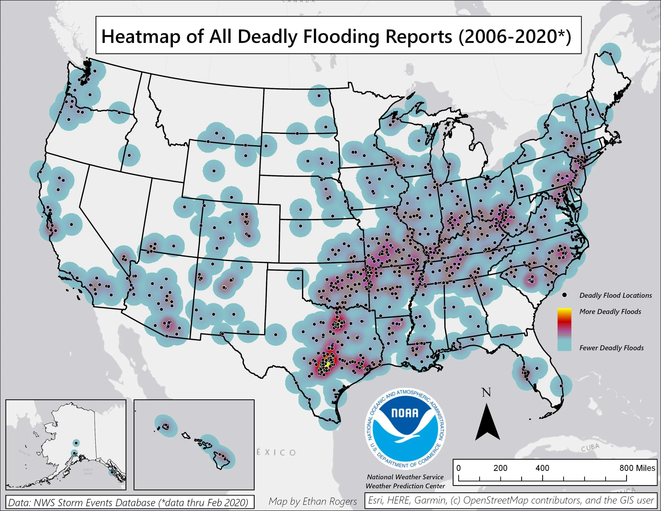
Heatmap of Deadly Flooding Reports (2006-2020) - NWS WPC
The morning of July 16th, 2026, is a rhyming history of July 4th, 2025. The Guadalupe River in the Hill Country of Texas is once again flash flooding catastrophically. The end results for those that live along the banks of the river are often tragic, the prime example being what happened at Camp Mystic, which dominated the national headlines.
Why this river, though? This is not a recent occurrence if you start looking back at the history of the Guadalupe. Over the past 100 years, major flash flood events have happened well over a dozen times in that watershed. Even smaller scale events prove deadly, as shown in this National Weather Service graphic, where between 2006 to 2020, no place saw more lethal flash flooding events than the Guadalupe River. Zooming out a bit, notice the high-density belt of these events stretching from the Dallas metro down through the Mexican border.
This is the outline of Flash Flood Alley, the lesser-known, but deadlier meteorological alley of the central United States.
Its existence is the result of several factors, starting with the geology. The feature defining the alley is the Balcones Escarpment, a fault zone that extends from the Red River down through Dio Rio. West of that escarpment is the famous Hill Country, which is comprised of layers of limestone, where water carved out aggressive watersheds over the years. The semi-arid nature of the region and surface soil composition makes it easier for the water to runoff rather than absorb into the ground. Periods of drought further increases the impermeability of the landscape. The terrain also has an influence on the meteorology above. Hill Country largely sits atop of the Edwards Plateau which offers orographic lift.
Orographic lift is terrain-influenced rising air. Due to the Ideal Gas Law (PV = nRT), the air cools as it expands condensing moisture present in the air mass. For the Hill Country, there are two massive sources of moisture; the Gulf if there’s onshore easterly flow, or the Pacific Ocean in events that are able to transport the moisture past the Sierra Madres and Chihuahuan Desert of Mexico.
The end result is moisture-rich tropical air masses encountering an area that geographically promotes precipitation. Simultaneously, that area has a hostile geological makeup for friendly hydrology, resulting in catastrophic flash flooding river basins. 99.9% of the time, the rivers that make up this region are barely running, requires dozens of dams along their stretches to even keep water in the basin. In that 0.01%, however, things quickly get out of hand.
Water doesn’t seem to get the respect it deserves on the severe weather front. For some reason, the high speed winds of a tornado or hurricane eyewall grab more attention. This has been something I’ve thought about a lot over the years and need to dive into it more. Anecdotally, I think it is partially because of the 3D visual component of moving air that is much more captivating than moving water. After all, we only see the roughly 2D surface of water (unless you’re in it) compared to constantly being immersed in air. Maybe it is because we live in the air versus water. Regardless of the reasoning, wind seems to garner more respect than water in a severe weather context.
The one fact I can use to emphasize the power of moving water is that it is 800 times more dense than air, meaning a given unit of water has 800 times more kinetic energy than a unit of air moving at the same velocity. That’s why a decent current knee-deep can easily take you off of your feet.
At the end of the day, moving water always wins.
If you were to ask a sampling of people in the United States to name types of severe weather, I’d bet on the most popular answer being hurricanes or tornadoes. This goes back to the idea of wind versus water, slightly, but it wouldn’t be surprising given they are the most tangible forms of weather being a direct threat to your wellbeing. They’re captivating phenomena, as the idea of swirling winds dismantling a house in seconds or the ocean being driven inland is hard to rationally fathom, so they exist as extraordinary standouts in our minds.
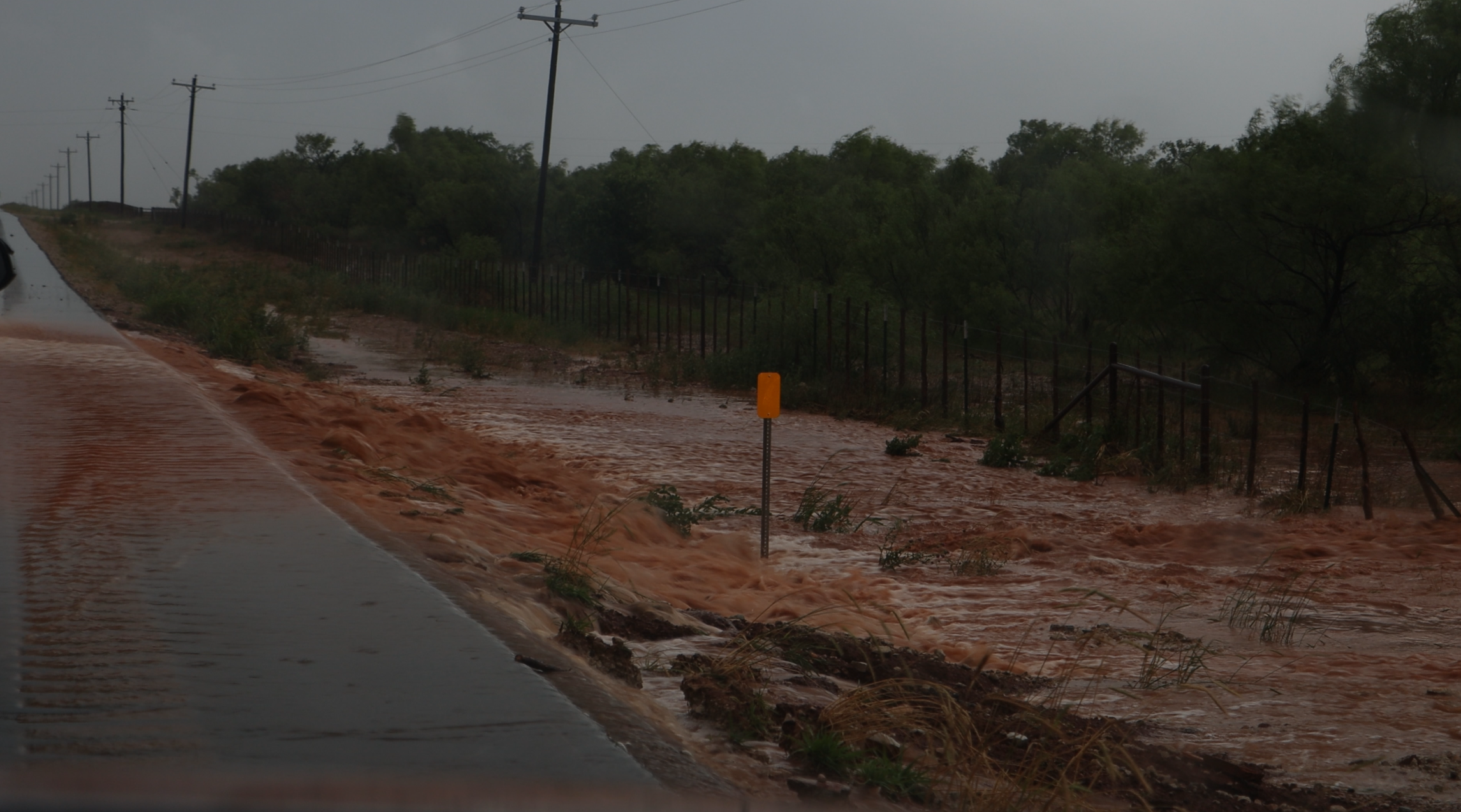
Some minor flash flooding on Texas road I encountered. May 25, 2025
However, flash flooding is less tangible for lack of a better term. It is easy to point to a tornado or hurricane as a threat because it's easily quantifiable. A damaging tornado. A major hurricane. But flash flooding is rather nebulous. How do you easily identify something out of a blob of heavy rain? Sure, you can draw up a box for a flash flood warning, but it’s still not as tangible as an oncoming tornado or hurricane (and even their warning polygons/cones are perfect communication devices). The blanket statement of watching out river banks, low water crossings, or urban low points is about the best you can do within a flash flood warning. There is no singular, tangible entity to point out. It remains nebulous.
The numbers behind it speak for itself. While maybe not as front-of-mind as hurricanes or tornadoes, it is the second deadliest weather hazard in the United States. Exploring the 30-year period of 1996 to 2025 in the United States, the average annual death toll from tornadoes was 72, 50 for hurricanes*, and 89 for floods (National Weather Service, 2025).
I’m not sure I have a good proposed solution for rectifying this issue at this time. It is easy to just point out a problem, it is a whole different beast to actually solve one. But if there’s anything I’ve learned from engineering, it’s that the key to solving a problem is first really identifying and defining it. As Einstein once said, “If I had an hour to solve a problem, I'd spend 55 minutes thinking about the problem and 5 minutes thinking about solutions.”
There will be more from me on flash flooding as I believe this an area of most importance on a severe weather communication front. But as I look at the orange-hued sky over greater NYC out my window, wildfires are definitely becoming a point of focus in my brain.
*wind-associated fatalities with tropical systems